What do you think of this routing @Dr.Badass? (definitely want @LeeGriffing’s input as well)
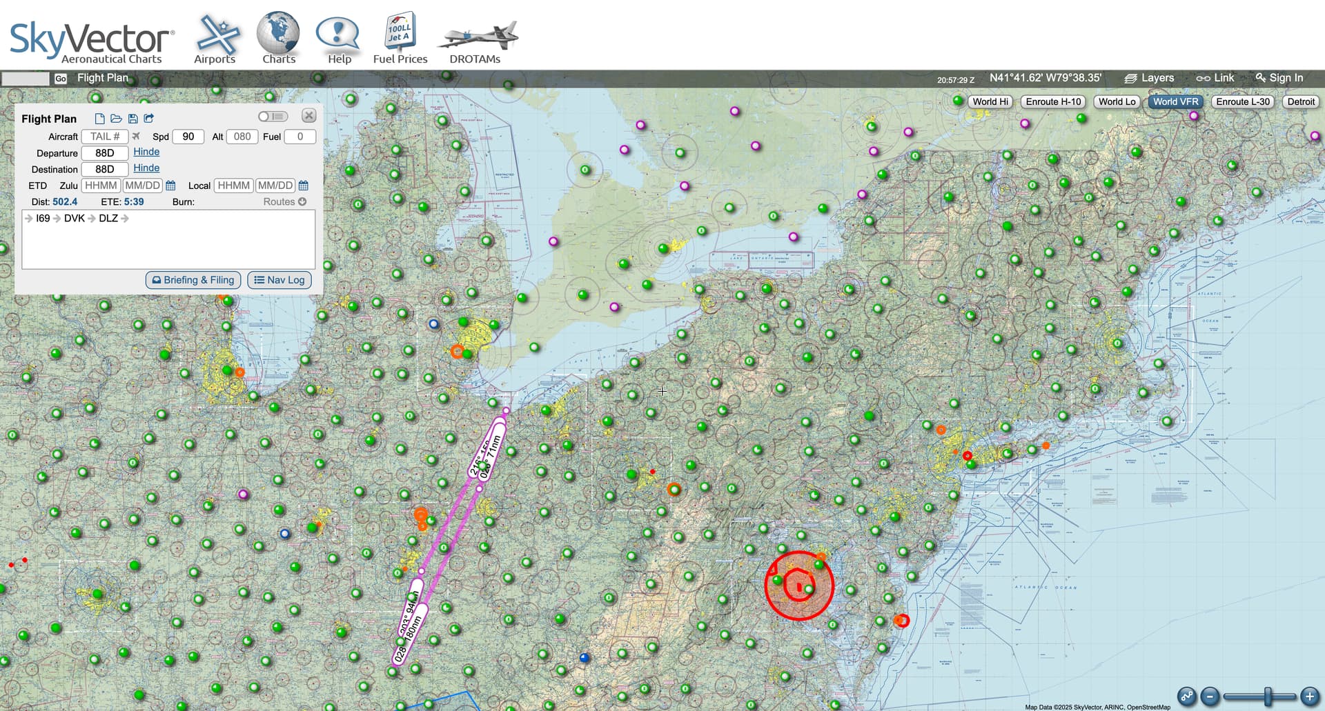
88D I69 (158NM) Claremont County Airport
Batavia, OH
Check out Sporty’s Pilot Shop in person for an hour (Free food from noon-2 on Saturdays)
I69 DVK (94NM) Danville-Boyle County Airport Stuart Powell Field
Danville, KY
This airport is exactly 250NM from 88D which is the minimum requirement for the flight to count. This airport also allows for our total distance flown for the entire trip to be 502.4NM.
DVK DLZ (180NM) Delaware Municipal Airport
Delaware, OH
We need a fuel stop. This seems to have a lot of food options in the area if we’re hungry. I have family in the area if we get stuck for some reason.
DLZ 88D (71NM) Hinde International
Huron, Ohio
Return home and drink some rum to celebrate our biggest aviation accomplishment this decade!
Yeah, I don’t dislike what you have planned there. I don’t have my iPad on me so I can’t easily look at better options but I’m gonna! Looks like you need a forelight subscription @RobertBerger Definitely gonna need it for that Cross Country.
When it comes to the Long Night XC for @Dr.Badass , one possible solution that I don’t think was mentioned in the podcast to mitigate his fear of night flights could be to fly over Highways. They will be lit with cars, but they will be sparse enough to not pose too much risk if you had to “lay er down hoss”
John Wick’s nephew… I remember you from the livestream chat! haha Welcome!!
I agree, Highways are great for night navigation and as potential landing spots in a night emergency.
Before 88D (@Dr.Badass’s Airport) had runway lights, we used to go in and out at night with just our local knowledge of how to do it. After doing it many times for years, we went late on a X-Country one time and didn’t get back until almost 3AM. Well… what we didn’t realize, was how much cars on the highway played a roll in our ability to know where the strip was… particularly the headlights. We almost couldn’t land that night because it through us off so much doing the approach without the reference of the unlit route 2.